Land Cover: This was
decided based on a paper by Crill,Gillman,Malaney, Stenz (2010) where they used
a 3,5,6,9,10 scale where Forest is the lowest and Cultivated crops the highest.
In between both of those are grassland, shrubbery and barren land. Ice and other
unstable surfaces were excluded due to construction issues. Similarly water was
excluded because of our inability to build farms on surfaces of lakes. We also
avoided building on cities and developed land, mainly due to the fact that we didn’t
want to build on top of a person’s house. We got our data from the U.S. Geological Survey and it came already color coded for us.
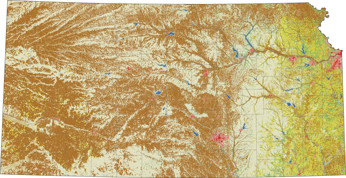
Figure 1. U.S. Geological Survey. (2011) National Land Cover Database. Brown is Cultivated Crops, White/Tan is Herbaceous, Yellow is Hay/Pastures, Blue is Bodies of Water, Green is Forests and Red is Highly Developed land.
